
History pervades everything.
If you’ve ever gone on a hike in the woods and unexpectedly discovered the remains of a crumbling barn, the shards of a glass bottle, or the fading traces of an abandoned path, you’ve seen this for yourself. So often, however, this fact is overlooked by our culture in its persistent race toward novelty, which is frequently presented as an unqualified good but should more accurately be considered a drug to distract us from what is truly important in life. Regardless of whether it functions as a sedative or stimulant, novelty is frequently nothing more than a relic of the past redecorated for modern consumption.
The irony of this situation is that confronting the complexity of the past in all its historical depth can provide a greater sense of novelty than any prefabricated commodity on the market. By going into the world, seeing for ourselves the impact of the past on the present, and extrapolating from the present to the future, we can begin to appreciate where we as a species have been and where we are rapidly heading. We can also begin to appreciate how much our own lives are interwoven with the lives of people whose last footstep came to rest on this planet centuries ago.
Not for the first time, I found myself in this position on the first weekend of May, when I took a hike on an unfamiliar stretch of trail at Eno River State Park. I’ve hiked portions of the Laurel Bluffs Trail in the past, but the trail is so long and hilly that I’ve only ever been able to traverse a small portion of it at a time. In this instance, I started from the Pump Station access on Rivermont Road in Durham and made my way northwest to the southern bank of the Eno River, where I then followed Laurel Bluffs Trail on its southwest trajectory toward the ruins of Cole Mill.

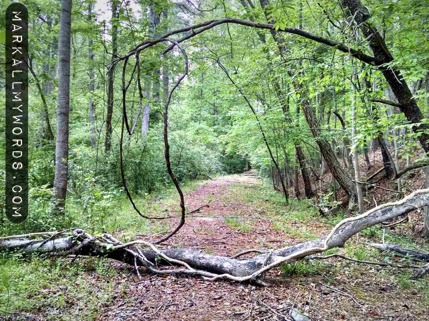
Laurel Bluffs Trail is one of the less frequented and consequently less well maintained trails in Eno River State Park. As such it can be somewhat treacherous in parts, especially when the trail suddenly veers up a steep incline or skirts the edge of an actual bluff. Nonetheless it’s also deeply peaceful by virtue of its seclusion and at times hypnotically beautiful in its serpentine dance along the banks of the Eno River. On this occasion in early May, as I navigated through the woods on Laurel Bluffs Trail, I was keenly aware of this.
I was also aware of the presence of the ruins of an old mill — which was originally called McCown Mill and later Cole Mill — on this stretch of the Laurel Bluffs Trail. In fact there’s a nearby road in Durham named Cole Mill Road, which to this day passes within a quarter mile of Cole Mill and was presumably named for its close proximity to the mill after it underwent a change of ownership in 1874. Though most people have no idea of the origin of the name of the road, it’s one small but pervasive way in which history has left its mark on the land.
The mark would never have been made, however, without the work of many people who lived in this area and ensured the construction of Cole Mill over two centuries ago. Foremost among these people was John Cabe, the owner of another mill a couple miles upstream, whose family was one of the most powerful and influential in Durham during the eighteenth and nineteenth centuries. Fulfilling his responsibilities as patriarch, John Cabe oversaw the construction of Cole Mill in 1813 as a kind of dowry for his daughter Rachel Cabe upon her marriage to Moses McCown.
The reason for this was simple. John Cabe had nine daughters and no sons, and during this period in American history women were prohibited from owning or inheriting land in their own name. If they were in a position to own or inherit land, it transferred to their husbands by default. This situation did not change in North Carolina until 1868, when married women were finally allowed to own property in their own name in the event that their husbands were irresponsible, imprisoned, or incapacitated. Therefore, if John Cabe wanted to continue to exercise power and influence over the region, he had to find some way to ingratiate himself to the man who would become Rachel Cabe’s husband and the legal owner of his lands. This John Cabe did by financing the construction of a mill and naming it after his son-in-law, Moses McCown.
This marked the beginning of Cole Mill, one of the more substantial mills in the region as indicated by the presence of a tilt hammer. A tilt hammer is a very large and powerful blunt instrument used primarily in smithing to refine ore and temper steel; this made it very handy in the time before steel mills were common in the United States. Below is a short video demonstrating a tilt hammer (also called a trip hammer) in action.
It represented a significant input of capital on the part of the mill owner and allowed the mill to perform a much wider range of operations than it would otherwise have been able to. In a sense, it was John Cabe’s way of making sure that Moses McCown fully appreciated how much he owed the older man.
But the marriage between Moses McCown and Rachel Cabe was not to last. In 1830, Moses McCown died, leaving Rachel the implicit but unrecognized owner of Cole Mill. To ensure that her children would inherit the mill uncontested, Rachel married another mill owner named Herbert Sims in 1831. Rachel’s family subsequently held the mill until 1874, when Rachel’s children sold the mill to John Anderson Cole, who gave his name to the mill. In 1908, however, the mill was destroyed in a devastating flood, after which time Cole Mill became little more than a footnote in history.
Aware of the presence of the old mill, I was keen to find as many traces of it as I could on my hike. After crossing under the overpass for Cole Mill Road, which is still functional to this day, I passed through the surrounding forest of beech and sycamore, noticed the leveling out of the trail on the flood plain, and finally caught sight of something ahead. There was a footbridge over a small creek, and I hurried to cross it.

After the footbridge, I noticed a side trail branching to the left away from Laurel Bluffs Trail. Peering into the distance, I caught sight of something that appeared to be an old stone hut. Intrigued by the thought of what it might be, I approached through the thicket of undergrowth, which wasn’t as well cleared now that I was off the main trail. When I came within ten feet of it, I stopped in my tracks and admired the handiwork which graced the old springhouse. This was the location where meat, dairy, and perishables would have been kept cool in the late eighteenth and early nineteenth centuries, before the advent of icehouses or refrigeration.

Returning to Laurel Bluffs Trail, I resumed my search for the ruins of the old mill. Before long, I noticed a cylindrical depression in the ground to my left, about twelve feet wide by five feet deep with sloping edges. Then something, actually two somethings, caught my eye. They were sitting on the southest side of the depression, opposite where I was standing. They were about four feet in diameter and were draped in undergrowth. They were undoubtedly millstones.
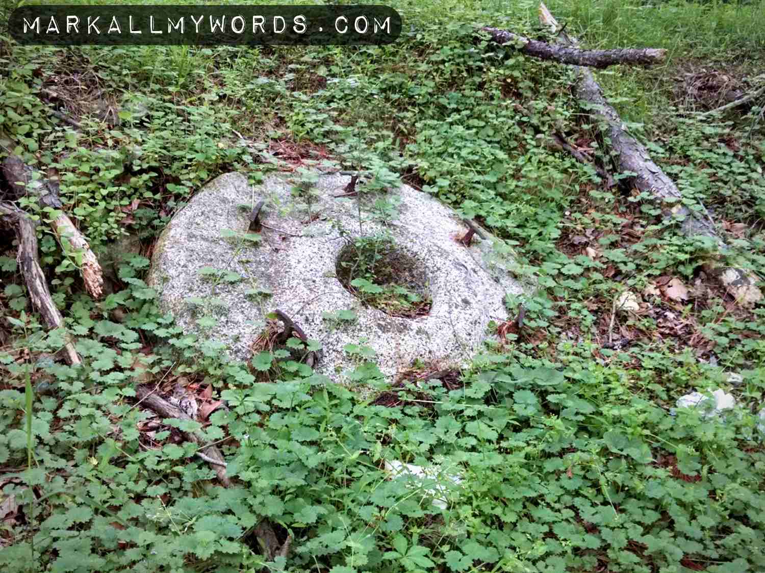
The first millstone I saw was the runner stone, which sits on top and rotates in a traditional gristmill. In this position it provides the necessary force to create friction to grind the grains which are fed into it from above. The circular hole in the middle facilitates the motion of the stone spindle, an axle which attaches to the runner stone and causes it to rotate.

The second millstone I saw was the bed stone, which sits on the bottom of a traditional gristmill. In this position it remains stationary while providing the counterforce necessary to create friction to grind the grains which fall between it and the runner stone. If you look closely, you can see the fissures where separate stones were plastered together to form the bed stone.
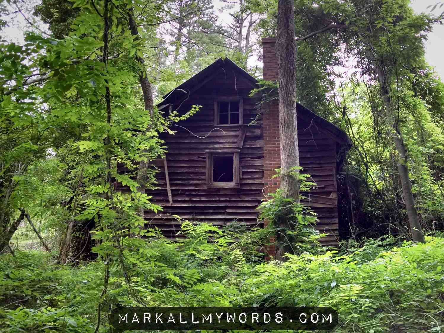
Continuing down Laurel Bluffs Trail, I came to a hill where another side trail branched to my left. Taking this trail, I ascended the hill by the side of a creek bed and came to an old abandoned cabin, surrounded by foliage and adjacent to a field. There was no clear indication of what purpose this cabin served, but it may have been associated with one of the ancillary businesses frequently attached to a mill: forge, general store, cotton gin, or distillery.
Turning west, I continued to explore the hillside. Before long I came to a clearing, after which I was able to discern the unmistakable traces of an old road stretching into the distance. To the south of this road, there were the remains of a stone foundation that stood about two feet high, most likely adjacent to a loading area where goods or materials could be shipped to market.
Backtracking to the cabin and descending the hill, I started hiking Laurel Bluffs Trail back to the Pump Station and my car. The trail was mostly deserted, but the views were pleasant and gave a distinct impression of what must have attracted so many early European settlers to this area in the seventeenth and eighteenth centuries. Certainly the beauty of the area must have been one of many reasons why John Cabe and his daughter Rachel chose to make a home for themselves on the banks of the Eno.

For my part, the beauty of the Eno Valley has been a great benefit to me over the past two years since I started hiking regularly. But there’s so much more than mere beauty to be found here and in any other wilderness. There’s a haven of peace and tranquility, a hotspot for health and fitness, and a great place for outdoor recreation. Beyond that, there’s a vital connection to the past in the form of historic sites such as Cole Mill, without which future generations will have no way to fully appreciate the importance of a crucial chapter in local history.
There are other additional reasons for the preservation of historic sites. For a start, they prompt us to reconsider what is truly important in life: freedom, nature, beauty, peace, health, and belonging. They beg the question of why our culture is so obsessed with and addicted to novelty for its own sake. They allow people to develop a real relationship with the land, without which our lives would not be possible. They reveal that history and the land are so deeply intertwined that it takes only the slightest scratching at the surface of one to uncover a wealth of knowledge about the other. Finally they show that if our species is to survive on this planet, we must protect both history and the land. Without them, not only will we starve; we will even forget who we are.

Mark, is there a way to support your work without using Patreon? Enjoyed your post on Fanny Breeze house ruins. I’d love to talk with you about what you think are most interesting things along the Eno (or other places you’ve visited along the Mts to Sea Trail.)
LikeLike
Looks like a great area for hiking!
LikeLike
Intriguing history. Fascinating to come upon the ruins of the mill. I agree with your readers. amazing stories. It stirs me to get around to explore the out of the way history that is all around us…
LikeLike