Last weekend I was finally able to explore the ruins of Holden Mill. I’d been wanting to for a couple months, but finding the requisite three hours of daylight proved to be more difficult than finding honesty in a politician.
I arrived at the Fews Ford Access (6101 Cole Mill Road, Durham, NC 27705) at Eno River State Park — where the ruins are located — in Durham, North Carolina, on Sunday afternoon to find a good number of other people who had the same idea.

Of course it’s not uncommon to find a crowd, but I figured the 40° F temperatures would dissuade my fellow Carolinians from venturing out. Starting northward on Buckquarter Creek Trail, I rounded the curve near Fews Ford and continued westward, encountering a few other small groups of hikers who were finishing the trail I was starting.

Before long I came to the Buckquarter Creek footbridge and crossed before arriving at a fork in the trail and taking the northern course. I had now come to Holden Mill Trail, which consists of two closely linked loops. The first of these is considerably larger than the second and extends from the banks of the Eno to a neighboring hill.
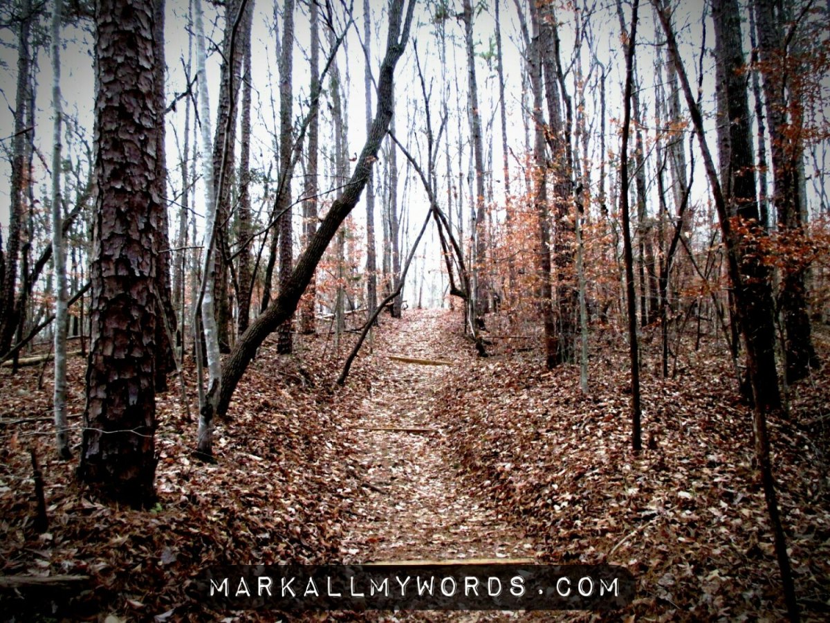
Cresting the hill, I noticed how the lack of foliage increased the visibility of the area considerably. When I came in November, there was still enough foliage to obscure a great deal of the surrounding landscape, giving the sense that so much legwork had been for naught. This wasn’t the case last weekend, and I was pleasantly surprised by how invigorating it was to see so much of the surrounding terrain.
The visibility increased further still, however, when I reached a clear-cut of power-lines, which looked as if a giant had used his scythe to scalp the land of her foliage.

By this time I was getting close. The trail had turned from westward to southward, and Tranquility Creek came into view. The trail continued on a course parallel to the creek for a little way before turning right abruptly at a shallow ford and leading me to the last stretch before the mill itself. I was pretty excited by this time and wasn’t exactly sure what to expect. I’d seen a few photos of the mill previously, but none of them had been particularly detailed. Thus my senses were fine-tuned and ready for anything.
The first thing to come into view was the defunct dam which once blocked this stretch of the Eno. It was very primitive and appeared to extend no more than ten feet in height, though it may have stood taller when it was built. I wasn’t able to get any decent photos of it, but there wasn’t much to photograph in any case.

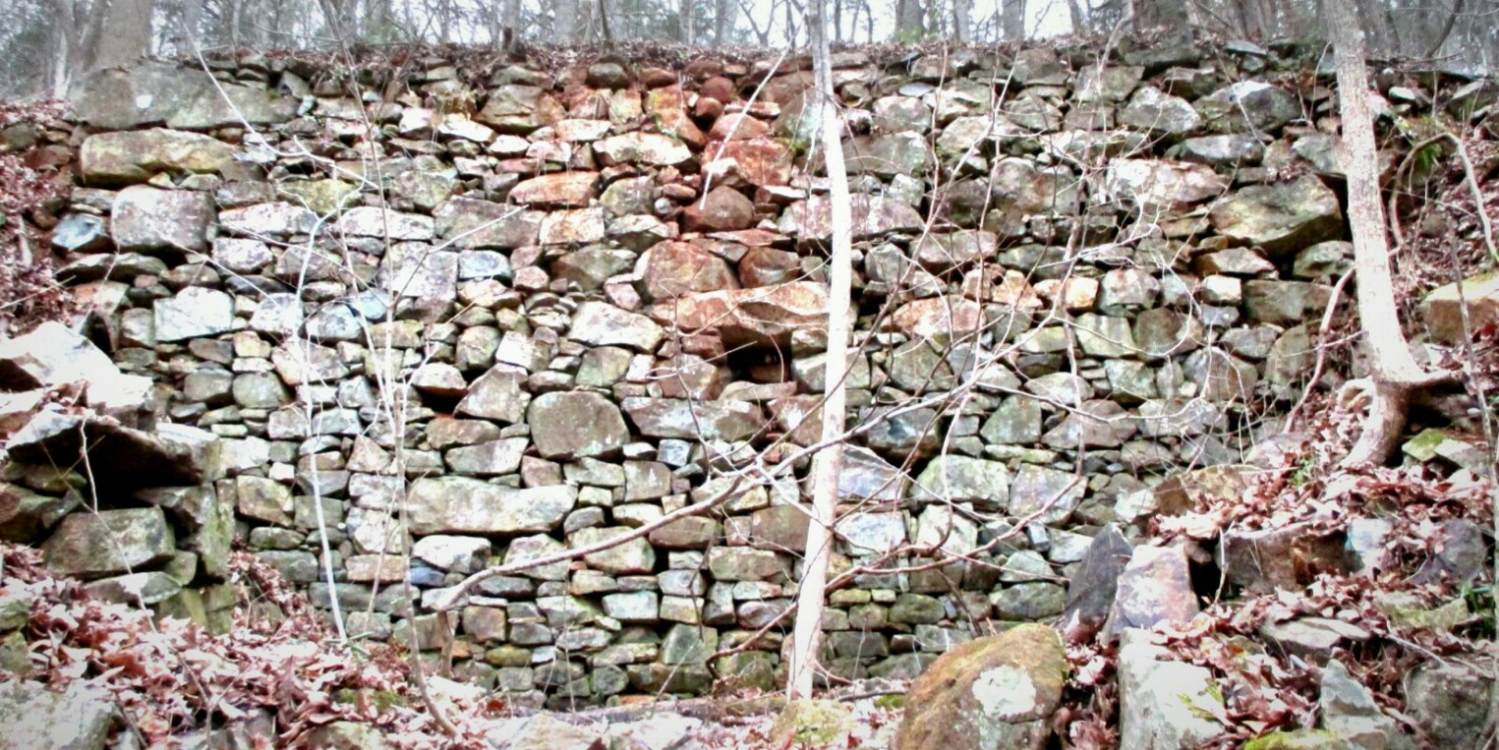
Then came the good stuff. Looming amongst the bare sycamores and oaks was a considerable stone structure that looked as if someone had transposed a fragment of Hadrian’s Wall to central North Carolina. Standing twenty feet tall and leaning slightly forward, this remnant of Holden Mill was an imposing sight and lent an air of antiquity to the landscape. In front of it stood two other fragments of the same structure, the first of which was no more than eight feet in height and the second no more than twelve. Together the three stone structures formed a kind of maze that simultaneously invited and dissuaded exploration.
On the one hand curiosity urged me to take a look for the sake of posterity, but on the other hand precaution urged me to watch for falling stones from a very old structure that’s clearly seen better days. I adopted the middle path, exploring what looked safe and avoiding what didn’t.

There weren’t any plaques or signs in the area to indicate what the ruins had previously been, but I have my own ideas.
The tallest wall in the back may have been the site of the mill wheel, which was probably considerable in size. The second wall may have redirected water from the mill wheel to a tail race emptying into the Eno. The third wall might similarly have acted as a buffer to keep the water from spilling prematurely.

All of this is guesswork of course, but I was also able to find something more substantial than guesswork in my research.
As it turns out, Holden Mill was founded as a corn, flour, and saw mill in 1811 by Isaac Holden. He owned and oversaw the mill for nine years before passing it to his son, Thomas Holden in 1820. Thomas Holden expanded the mill’s workload to include cotton, oil and threshing before passing it to his son-in-law, John Lyon, in 1851. John Lyon retained the mill until 1868, when the mill was closed due to financial difficulties.
For fourteen years it remained shuttered. Then, in 1882, Samuel Cole re-opened the mill and oversaw its operation until 1893, when the mill closed for the second and final time. With the increase in coal-powered factories, the water mill was now obsolete, its role in the economy reduced to a footnote in history.
As I began the return leg of my hike, I still had visions of decaying stone foundations in my mind, covered in moss and leaves but begging for some definite explanation. And while I can’t say for certain that all of my guesswork is entirely accurate, I can say one thing: you really ought to see it for yourself.

Incredible photos. I especially like the stone staircase. Looks like something out of Lord of the Rings.
LikeLike
I am a NC native and have not heard of this place, thanks for the illumination. Beautiful pictures. My family lived for a time in rural NJ and behind our house was a brook that looked just like the photo of the river (somewhat narrower)– Rock Brook. Thank you, too for visiting my blog!
LikeLike
Very informative. And nice pictures, too. I’ve passed by Eno park many times, but have never visited. Looks really pretty.
LikeLike
I love these, Mark! Thanks for the post.
LikeLike
That looks like a beautiful hike anytime of the year. Loved the Trinity Creek photo but they were all stunning pictures.
LikeLike